Mineral Perspectivity Mapping in the Montana Region Based on a Combination of Variations in Gravity, Magnetic, and Geochemical Data Using Likelihood Ratio and Fuzzy Logic Methods
Keywords
Fuzzy, Gravity, Likelihood, Magnetic, MineralAbstract
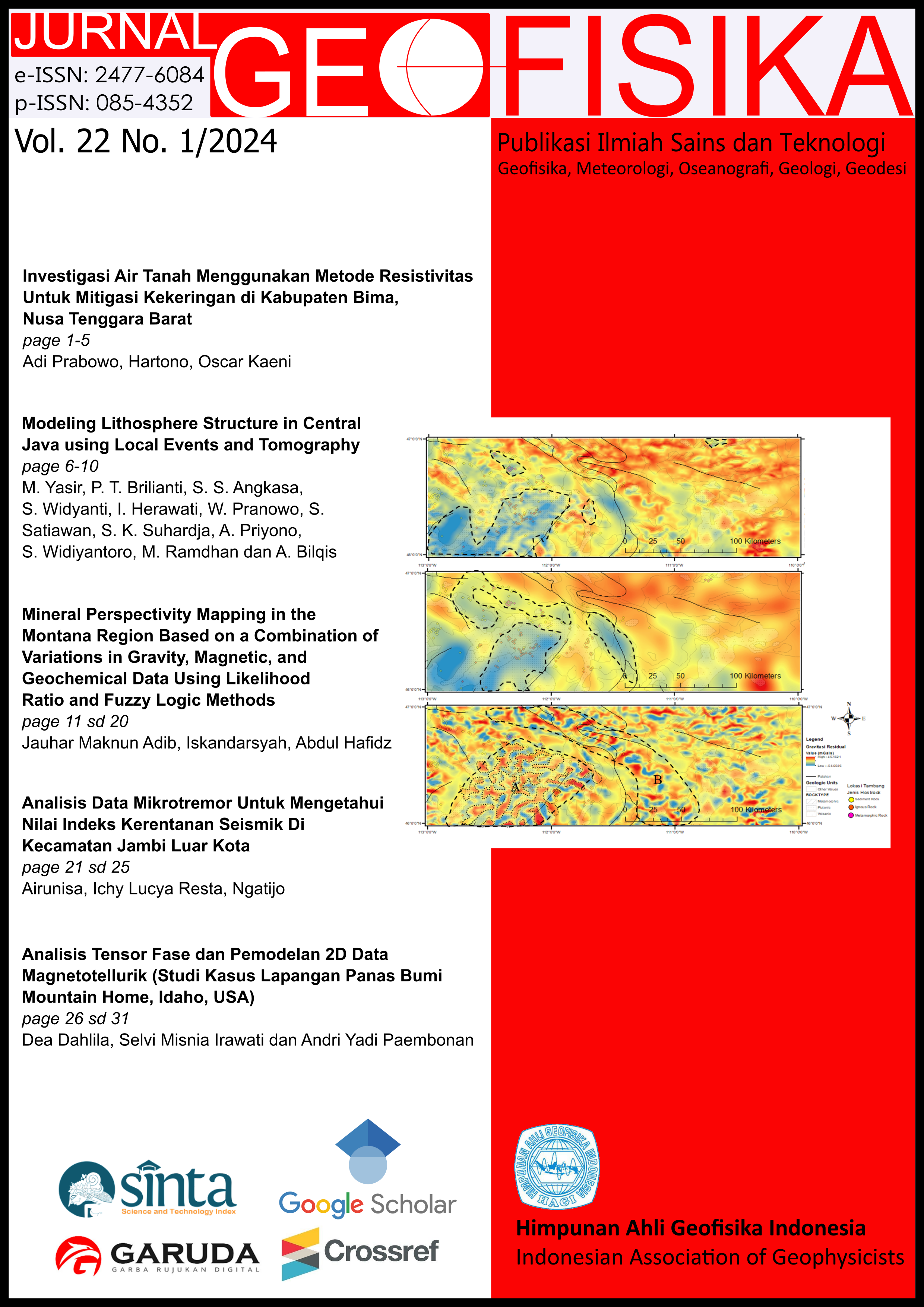
Montana is a province in the United States which is nicknamed the "Country of Treasures" because it has a variety of metal commodities so mapping the mineral prospects in Montana is very interesting. It is necessary to understand the mineralization of porphyry deposits at the research site to determine the role of gravitational, magnetic, and geochemical data. In this study, the data integration used is the likelihood ratio and fuzzy logic methods to obtain ore body maps, mineralization grade maps, and mineral prospect maps at the research site. From the variation of gravity and magnetic data, a map of the distribution of the ore body is obtained. From the geochemical data of Au, Ag, Cu, As, Pb, and Zn, a map of the mineralization level in the study area was obtained. The ore body potential map and mineralization level map are combined again to get a mineral prospect map. then all map results from the likelihood ratio method and the fuzzy logic method are interpreted and compared. From the mineral prospect map, the authors succeeded in mapping the mineralized zone to select exploration targets with a total area of mineralization obtained of 8223 Km2 with the widest area of 2868 Km2 in plutonic rock types with granitic lithology
References
Hronsky, J.M.A, and D.I Groves. 2008. "Science of targeting: definition, strategies, targeting and performance measurement." Australia Journal Earth Science 55: 3-12.
Kainz, Wolfgang. 2010. The Mathematics of GIS. Vienna: University of Vienna Press.
Lee, Saro, Hyun-Joo Oh, Chul-Ho Heo, and Inhye Park. 2014. "A case study for the integration of predictive mineral potential maps." Central European Journal of Geosciences 373-392.
Reynolds, John M. 2011. An Introduction to Applied and Environmental Geophysics 2nd Edition. Oxford: Wiley Blackwell.
Rojas, Raul. 1996. Neural Networks: A Systematic Introduction. Berlin: Springer-Verlag.
Sutphin, David M. 2005. "A Geochemical Atlas of South Carolina--An Example Using Data from the National Geochemical Survey." U.S. Geological Survey Open-File Report.
Yousefi, Mahyar, Emmanuel John M Carranza, Oliver P Kreuzer, Vesa Nykanen, Jon M A Hronsky, and Mark J Mihalasky. 2021. "Data analysis methods for prospectivity modelling as applied to mineral exploration targeting: State-of-the-art and outlook." Journal of Geochemical Exploration 229.
Yousefi, Mahyar, Oliver P Kreuzer, Vesa Nykänen, and Jon M.A Hronsky. 2019. "Exploration information systems – A proposal for the future use of GIS in mineral exploration targeting." Ore Geology Reviews. doi:https://doi.org/10.1016/j.oregeorev.2019.103005.

This work is licensed under a Creative Commons Attribution 4.0 International License.
The copyright of all articles belongs to the authors. All other copyrights is held by the Journal